Tocht Mountainbike Le Monastère - Rodez Agglomeration - Circuit 1 - Les ponts de pierre - Photo

Rodez Agglomeration - Circuit 1 - Les ponts de pierre

 randoruthene
randoruthene

Gebruiker

© OpenStreetMap contributors
Lengte
Lengte
17,4 km
Max. hoogte
Max. hoogte
660 m
Positief hoogteverschil
238 m
Km-Effort
Km-Effort  
21 km
Min. hoogte
Min. hoogte
587 m
Negatief hoogteverschil
236 m
Boucle
Boucle
Ja
Datum van aanmaak :
2020-07-27 09:38:53.663
Laatste wijziging :
2020-07-27 09:41:08.33

(0 Bericht)

Mountainbike
Mountainbike
1h22
Moeilijkheid : Gemakkelijk

Scan deze QR-code om de tocht te openen in de SityTrail-applicatie

Gratisgps-wandelapplicatie

Logo SityTrail SityTrail

IGN / Geografische instituten

SityTrail uit de App Store downloaden SityTrail uit Google Play downloaden

Logo SityTrail SityTrail World

De wereld gaat voor u open

SityTrail uit de App Store downloaden SityTrail uit Google Play downloaden SityTrail op Huawei AppGallery downloaden

Over ons

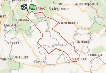
Tocht Mountainbike van 17,4 km beschikbaar op Occitanië, Aveyron, Le Monastère. Deze tocht wordt voorgesteld door randoruthene.

Beschrijving

Espace VTT Rodez Agglo - 400 km de chemins balisés - 18 circuits labéllisés FFC
Les points marquants de ce parcours :
• Le Domaine de Combelles, situé sur la Commune du Monastère, au cœur d’un parc de 120 hectares de causse, de forêts, de prairies est un site privilégié de nature et de loisirs, où l’on peut se détendre en famille, bénéficier des activités du centre équestre et de l’hébergement du village-vacances.
• Deux traversées de gué sur petit pont en dalle de pierre.
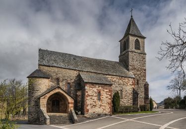
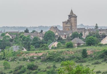
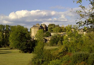
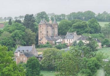
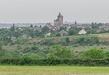
• Le château seigneurial d’Hyars du XIVe siècle, situé sur la commune de Ste Radegonde.
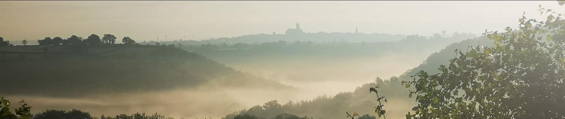
• Un magnifique point de vue sur Rodez et sa cathédrale.

Hoogteprofiel

Foto's

Plaatsbepaling

Land:
France
Regio :
Occitanië
Departement/Provincie :
Aveyron
Gemeente :
Le Monastère
Locatie:
Unknown
Vertrek:(UTM)
467419 ; 4908692 (31T) N.

Wandeltochten in de omgeving

Tocht Te voet Rodez - Randonnée de Rodez Agglomération Circuit n°2 - Layoule - Photo
Te voet
PRO

Te voet

Gemakkelijk
Rodez, Occitanië, Aveyron, France
5,6 km | 6,6 km-effort
1h 29min
Ja
Tocht Te voet Onet-le-Château - Circuit 16 Moulin de cantarane - Photo
Te voet
PRO

Te voet

Gemakkelijk
Onet-le-Château, Occitanië, Aveyron, France
6,3 km | 8 km-effort
1h 48min
Ja
Tocht Te voet Sainte-Radegonde - Circuit 14 Sainte-Radegonde - Photo
Te voet
PRO

Te voet

Gemakkelijk
Sainte-Radegonde, Occitanië, Aveyron, France
12,2 km | 16,2 km-effort
3h 40min
Ja
Tocht Te voet Le Monastère - Circuit 11 Le Monsastère - Photo
Te voet
PRO

Te voet

Gemakkelijk
Le Monastère, Occitanië, Aveyron, France
6,4 km | 7,9 km-effort
1h 47min
Neen
Tocht Te voet Luc-la-Primaube - Circuit 10 La Capelle Saint-Martin - Photo
Te voet
PRO

Te voet

Gemakkelijk
Luc-la-Primaube, Occitanië, Aveyron, France
9,6 km | 11,8 km-effort
2h 40min
Neen
Tocht Te voet Luc-la-Primaube - Circuit 9 Planèzes - Photo
Te voet
PRO

Te voet

Gemakkelijk
Luc-la-Primaube, Occitanië, Aveyron, France
8,8 km | 11,5 km-effort
2h 37min
Ja
Tocht Te voet Olemps - Circuit 8 Le Viel Olemps - Photo
Te voet
PRO

Te voet

Gemakkelijk
Olemps, Occitanië, Aveyron, France
5,1 km | 6,5 km-effort
1h 29min
Ja
Tocht Te voet Rodez - Via Piodensis - Rodez - Photo
Te voet
PRO

Te voet

Zeer moeilijk
Rodez, Occitanië, Aveyron, France
113 km | 150 km-effort
34h 12min
Neen
Tocht Te voet Sainte-Radegonde - Sainte-Radegonde - Photo
Te voet
PRO

Te voet

Gemakkelijk
Sainte-Radegonde, Occitanië, Aveyron, France
9,9 km | 13,2 km-effort
2h 59min
Ja


Sluiten
Mijn abonnementen